Join us for a little bit of island life!

Tuesday, 30 August 2016

Cumbrecita and El Paso Visitor Centre

The larger towns on La Palma have a Visitor Centre and this is where you can get maps, leaflets and guide books along with help and information from the staff. Just be aware that they generally close between about 13.00hrs and 16.00hrs. However, if you are looking for information on the Caldera de Taburiente, the Cumbrecita, Volcano Route and the topography, flora and fauna of the island, then the El Paso Visitor Centre is a good place to go and it's open all day.

Happily, it's really easy to find as it's located right next to the LP3 main road which runs between the east and west coasts, just at the 20km marker. This is also where the road goes up to La Cumbrecita. A word of caution - please do observe the speed limits in this area on the LP3!
Where are we? This is where you can find out about the National Park
The Cumbrecita is one of my many favourite jaunts on the island and it gives a great overview of the immense Caldera de Taburiente. Mr. Rother's Walking Guide also likes it quite a lot too so I'm in good company - he says that if you only do one walk on the La Palma, this should be it! And I have to say that I probably agree. You can read our blogpost about the Cumbrecita here.
La Cumbrecita walk
If you are thinking of driving up to the Cumbrecita, then you need to get a ticket from the El Paso Visitor Centre for the car as parking is limited ie, not many cars can get parked because there isn't much space. So it's a bit of a queuing system just like in the supermarket. Sometimes you can go up straight away and at peak times, there could be a long wait. My suggestions is that you ask at the reception when you arrive how long the wait is rather than looking at the exhibits in great detail and then discovering that there is a 40 minute wait before you can go up to to the Cumbrecita. If needs though, there is a bar/cafe directly opposite to while away the time.
My favourite exhibit at the Visitor Centre is the relief map/display of La Palma. I look at it and think, good grief - do we really live there! 'There' is at 500m above sea level, half-way across the north coast in what is the most mountainous region of La Palma. But more importantly it gives you a really fantastic overview of La Palma and just exactly why the roads are so twisty!
 Looking at the information panels, you can also discover how La Palma used to be divided up into the various municipalities. You might notice that there has been a bit of political shuffling round and Tazacorte has now become a municipality in its own right.
If you have time, you might like to wander over to the botanical garden or watch the 20 minute video on La Palma which is available in Spanish, English, German and French.  The Spanish video is on every hour on the hour.  The other languages are on every half-hour. In all cases, go to reception to ask for the video to be played, if not already on. Everything is free by the way.
Also free is the sight of the Old Man of the Mountain. This is not quite the best vantage point from which to view the apparent profile of an old man laying down. However ... to the left in the picture, he is clasping his hands together over his stomach. Looking along to the right, the profile dips down to his neck and then a vertical rise to his chin, lips and nose. The saying is that when the old man rises, then La Palma will disappear beneath the waves.

Opening times:
The Cumbrecita car park and walk is open from 08.30hr to 19.55hrs seven days a week, No toilets or other facilities available by the way.
The El Paso Visitors Centre is open from 09.00 to 18.00hrs seven days a week, toilets are available. Parking is right outside and free. If approaching from Santa Cruz in the east, slow down as you approach 20km and turn into the car park. If approaching from Tazacorte/El Paso/Los Llanos in the west, turn into your right where there is parking on your side of the road opposite the centre. Because it is situated next to the main road, please take care at all times.

Wednesday, 27 July 2016

Swimming around La Palma

There is one thing about an island you can guarantee – there's always plenty of water around! And whilst La Palma is often known as a walking destination, it would be a real shame if it was overlooked as a beach destination as well.
Los Cancajos beach
If you are in the area of Los Cancajos near the capital, the beaches there would certainly get our vote. Here you will find three lovely inter-linking beaches with easy access in and out of the sea, the water is clear and the fish are usually in abundance which also makes it perfect for snorkeling.
Another nearby beach is just 1km south of the capital, the Playa Bajamar. And further up the coast is the Playa Espindola near San Andres - all good, sandy beaches with easy entry.
And of course let's not forget the main beach at Santa Cruz itself, right across the road from the historic mansions. It's not open to the public yet, but hopefully the grand opening is not too far away!
Santa Cruz beach
Over on the west side, a popular beach is at Tazacorte at what you might call Tazacorte village where there is also a great range of apartments and restaurants. It almost never gets crowed although in August it's pretty busy. Tazacorte is often cited as having the most sunshine hours year round in the whole of Europe!
Tazacorte beach, 31 December
Tazacorte beach - August
Not too far down the coast is Puerto Naos, also a popular place for its beach and apartments. Plus it's got a great new promenade now, very swish!
Beach at Puerto Naos
However, another favourite place to swim is La Fajana de Barlovento which is in the North West. It is not too far off the main road, parking is easy and the water is nearby. There is no actual beach but plenty of terraced areas to get laid out in the sun and the facilities are among the best on the island with free, scrupulously clean toilets and showers too.
La Fajana de Barlovento
 In summer, the sea is fantastic for swimming and great for snorkeling. But the sea pools are also surprisingly good. The three pools have something for everyone from small children to keen snorkelers as the main pool is quite large and just over 2 meters deep. The water is again crystal clear and they are all absolutely teeming with fish. And - it is quite an experience to swim in the calm water of the pool.
Sandy cove below Puntagorda
But there are many hidden coves around the island too and if you're a bit of an explorer, then get your map out and - discover! Take a look around Los Canarios in the far south, Puntagorda in the north west, Puntallana in the east, they all have little coves where you can lay on the beach and enjoy a swim in the clear waters of La Palma. Enjoy!

Friday, 10 June 2016

Fiesta of the Sacred Heart, El Paso


Last week, the 5th June, in El Paso was the beautiful fiesta of the Sacred Heart of Jesus. It's one of those fiestas which is not all about party time but more about reflection and celebration. Firmly with a religious base, it's very much worth a visit whether religious or not.

The amazing thing about this annual celebration is the way the decorations are made, an incredibly painstaking labour of love using natural materials and which literally takes months. 

The procession starts from the church of the Conception of Bonanza in the upper part of El Paso and then down into the town. Along the way the streets are decorated with handmade lanterns to light the way, arches and tapestries of flowers and seeds that depict various images. They are all created with natural materials made by different neighbourhoods, groups, associations and individuals and take months to make - and just for this day.
All the various areas of El Paso contribute including El Paso de Abajo, Tajuya, La Rosa, Camino Viejo, Fatima, El Calvario, Tenerra, artists Rodrigo Gonzalez de Paiz and Carlos Afonso, the Red Cross, the Center for Disability Care in Triana and different schools in El Paso.

Tuesday, 31 May 2016

Walking the GR130 Camino Real - Barlovento to Franceses

We are having a great time re-walking our local walks along the GR130! Our latest one is the Barlovento to Franceses route which is a grand tour through nature with some breath-taking views. When it comes to features in a walk such as wooded trails, cliff tops views and emblematic villages, it really does come out tops.
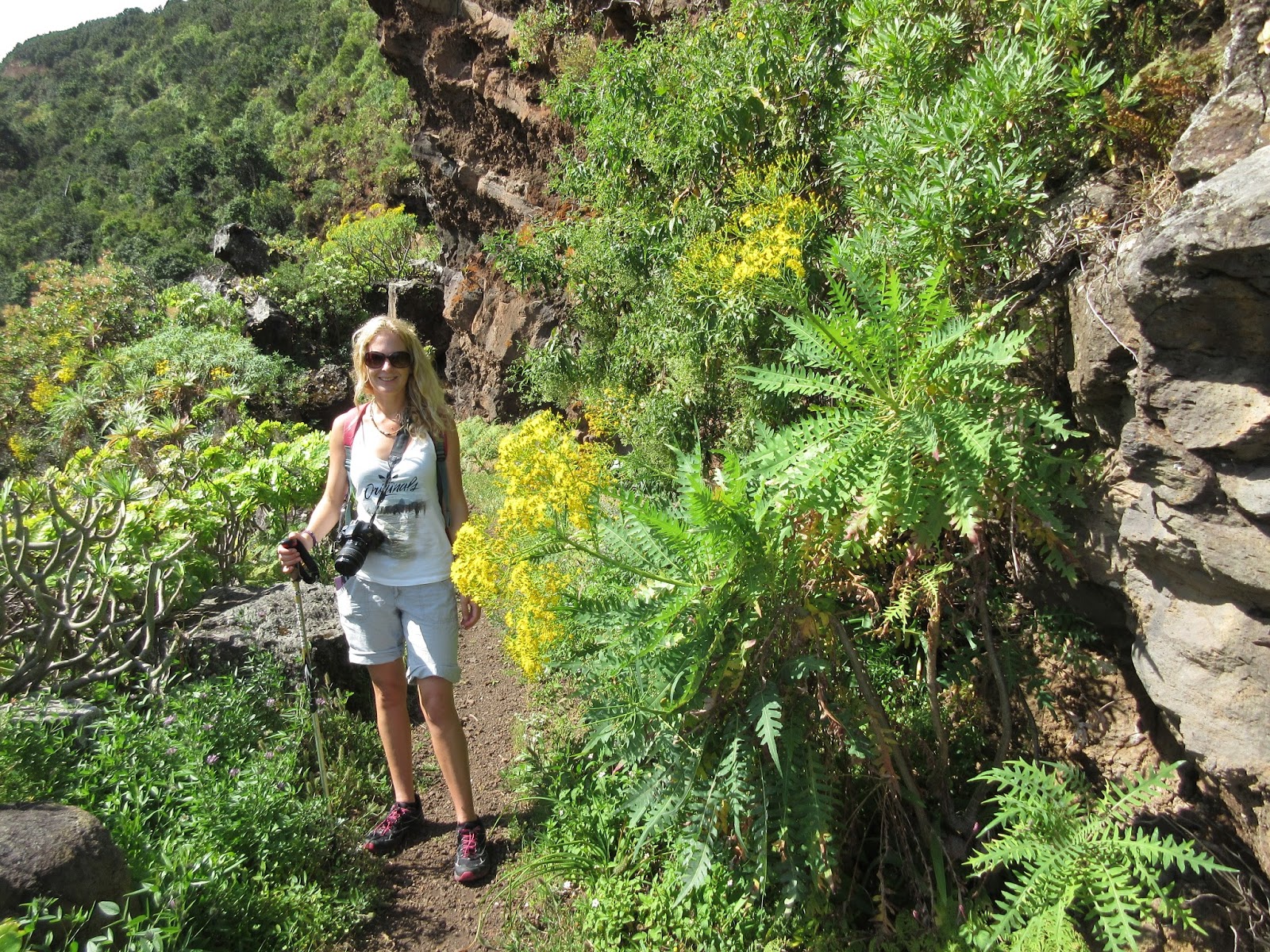
And since this walk is included in our self-guided luggage transported walking itinerary, we kept the walk pure by starting at the Hotel Romantica at the top end of Barlovento town. That way, we can record it faithfully on Endomondo. And with my daughter along for the walk, that's definitely an added bonus! (Just in case you get mixed up, she's the leggy blonde and I'm the er, well not so leggy. Or blonde :)
So having started out from the hotel, it's a pleasure to go through the little wooded walk which brings us out at the top end of town. From there we stride out along the road with calls of 'why are we walking so fast?' It's a long way to go! Since it's a flat road, we don't like to dawdle but the road doesn't last long before we are on what you might call the trail proper.
The first part of this particular walk is, I would say, easy but it's only 30 minutes from the start before we get our first wonderful sea view. This is as we walk by the hamlet of La Tosca and the famous Dragon Trees of La Palma. It's also where the old, stone laundry basins are. The are fed water from one the many natural springs and it's good to imagine a whole gaggle, can I say, of women with their washing. In fact, we've got one of these old laundry basins at our own house in Franceses. I dimly recall thinking that I might 'go native' and use that instead of any automated means. I think that idea lasted about two weeks before I was off to look at Hotpoints and the like!
The laundry basins on the trail are now filled with greenery so obviously the local ladies have caught onto to mod-cons as well.
Then we're off into the wild green wonder with a myriad of exotic plants such as Agave, Stone Crop and the effervescent Sow Thistle. But caves are always fascinating too and although the big one on this section is more of an overhang, there are still remnants of where goats have been kept. You can also very clearly see the different strata in the rock face. But it's all very pretty wherever you look :)
So that's playtime over as we commence with a little barranco. In fact it hardly earns the name of barranco (ravine) because the main ones are much deeper at around 400m deep. Now it's onward and upward, or rather downward and upward into the deep Barranco de Gallegos before we get to the hamlet of La Crucita. In fact, there are only about ten houses here and because we cross the 'village' road almost before the houses have begun, we don't get to see many of them before trekking off down into the next barranco. But this one is very small and  the great thing is that there are some amazing caves to see laid out over three levels. Definitely worth pausing and having a peek inside.
At the top of the slope, we come to our half-way point and the lively village of Gallegos. I say lively because many Venezuelans live there and because it is the largest village across the north. But then again, it can very, very quiet ..... There is a bar/cafe though and it would seem almost rude to pass through without even a nod or better still a cold drink. There is even a little village shop over which the barman presides and he's more than happy to let you have a quick browse if you need any village shop items.
So suitably prepared for the next half, it's down the slope as we go towards the sea. And I think this time, we are walking rather more slowly than the first half - mainly due to the astounding view. We are quite a bit closer to the sea now, although still quite high, so the views really are show-stoppers. It's quite hard to tear ourselves away from the mirador! (lookout point)
Just 20 minutes later, we've reached the bottom of the second barranco and into what we like to call 'Mexican Valley' but what is actually the Barranco de Franceses. We love it because of the huge, smooth stones underfoot that form the ravine bed, the concentrated heat, the stillness and the cactus. Hey – Méhico! Actually, the cactus are Cardon or Candelabra cactus.
And it's not one ravine but two as it's a double dip - rising slightly before dipping down again. Although the rise between the two only takes 15 minutes and I think it's quite a special part of the walk to be enjoyed and not rushed. It's two for the price of one if you like to look at it that way and the rise in the middle is kind of fun. The incongruity of the zig zag path with us only moments apart but on an entirely different level is quite funny. (You might need to study the photo below to understand what I mean.)
Arriving at the base of the ravine on the other side of the rise, this time there is no cactus but a relatively large, flat area of multi-coloured, multi-shaped small stones rather reminiscent of a beach. There's also a craggy overhang which is a great place to enjoy some shade. If we want to get home in time for an afternoon cuppa though, it's time to press on. From here, it's a case of up, up and more up - with many rewards along the way. First a vertical spyhole quickly followed by a mirador complete with stone bench and a horizontal spyhole. Actually that spyhole is an arch of hard stone resting on a dip of softer stone.
It's also a good place to look back and see where you've come from and how far you've walked. There's quite a sense of disbelief as we look towards Barlovento in the distance!
Continuing up the path, there are a few teases by way of some houses dotted about. My suggestion is that you don't let this lead you into thinking you are almost 'there' because you've still got some more uphill work to do. And then when you reach the asphalt road, it's still another 30 minutes back to base, if going all the way to Las Tierras. But first of all you get to walk along the exquisitely narrow village road of Los Machines before entering the last, beautiful dell of Las Tierras, all still part of the stretched out area known as the French Quarter or Franceses.
Was this a good walk? You betcha!
* Our self-guided Luggage Transported walks include:

  • Highly-detailed walking notes (for the Barlovento to Franceses walk, 3 x A4 sheets)
  • Km guide with all walking signs integrated to keep you on track
  • Points of interest to make sure you don't miss salient features
  • Our own walk profile complete with distances and timings
  • History of each town en route

    For more information on Holiday La Palma self-guided walks, take a look at our webpage here:
    http://www.holiday-lapalma.com/luggagetransportedwalking.html
    or Contact us here: ann@holiday-lapalma.com